
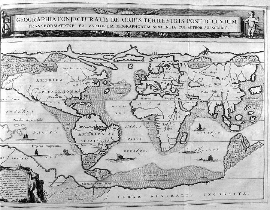
🔴A 1675 map by Athanasius Kircher with the telling title "A Geographical Map of the World After the Flood.
If you leave out Atlantis, shown near North America, the map shows the coastal parts of continents that have gone under water in recent years. The Aral Sea and the Caspian Sea are connected into one body of water. What is worth paying attention to: the map is drawn as if the author witnessed the events or redrawn from other more ancient maps. What archaeologists are now finding underwater is perfectly overlaid on this map.
If you leave out Atlantis, shown near North America, the map shows the coastal parts of continents that have gone under water in recent years. The Aral Sea and the Caspian Sea are connected into one body of water. What is worth paying attention to: the map is drawn as if the author witnessed the events or redrawn from other more ancient maps. What archaeologists are now finding underwater is perfectly overlaid on this map.
08:23 AM - Nov 13, 2021
Only people mentioned by r363ll10n in this post can reply