
VAL THOR
@VALTHOR
05 January, 01:33
(E)
AndTartary and antiquity
andtartary2
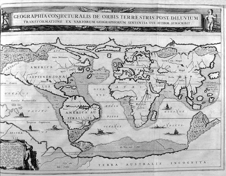
A 1675 map by Athanasius Kircher with the telling title "A Geographical Map of the World After the Flood.
If you leave out Atlantis, shown near North America, the map shows the coastal parts of continents that have gone under water in recent years. The Aral Sea and the Caspian Sea are connected into one body of water. What is worth paying attention to: the map is drawn as if the author witnessed the events or redrawn from other more ancient maps. What archaeologists are now finding underwater is perfectly overlaid on this map.
andtartary2
A 1675 map by Athanasius Kircher with the telling title "A Geographical Map of the World After the Flood.
If you leave out Atlantis, shown near North America, the map shows the coastal parts of continents that have gone under water in recent years. The Aral Sea and the Caspian Sea are connected into one body of water. What is worth paying attention to: the map is drawn as if the author witnessed the events or redrawn from other more ancient maps. What archaeologists are now finding underwater is perfectly overlaid on this map.
Notice: Undefined index: tg1tga_access in /home/admin/www/anonup.com/themes/default/apps/timeline/post.phtml on line 396

Really cool. Bookmarked to my Tartaria stuff. I need to check it out better later. Thanks! 😊👍😊
03:59 AM - Jan 05, 2024
In response VAL THOR to his Publication
Only people mentioned by Cathyldup in this post can reply